John Roper has documented damage from growing high tides along Gibsons waterfront for decades; urgent work needed within 5 years

(By Margot Grant)
A report by retired engineer John Roper points to increasingly high tides and potentially catastrophic consequences for the Town of Gibsons, and Mayor Bill Beamish says staff are “concerned about this issue.”
Roper, who has 32 years of experience in command of training vessels based in Vancouver and Gibsons, has recorded changes in tides and barometric pressure during that time, and sent his report to the town last week. He has provided information to the Town of Gibsons since 2006, but says he has seen no evidence of any understanding or strategic planning on the part of the town.
Mayor Beamish told The Coast Clarion “we do address vulnerable infrastructure in our draft strategic plan as a priority.” The draft of the town’s strategic plan for 2019-2022 says it aims to “increase the resiliency of our community and its infrastructure to the local impacts and risks from climate change.”
The town wants to “develop and adopt a comprehensive climate resiliency strategy” and “continue to address climate change risk in asset management plans,” the draft adds.
Fisheries and Oceans Canada predicts tides of up to 5.1 metres at Gibsons Harbour on 34 days until the end of this year. Coupled with low atmospheric pressure and high winds, that level could rise another 0.9 metres, as happened in Point Atkinson on December 16, 1982.
If overall sea levels rise another metre by 2100 as expected, local tides of 7 metres could result, Roper warns. He says parts of public infrastructure and 50 of the most vulnerable private properties need to be upgraded within the next five years to avoid substantial flooding and wave-impact damage.
On February 4, 2006, he photographed waves crashing over the sea walk south of Coles Marine Ways, as well as the flooding of several properties near Hyak Marine. This happened despite the fact that the water level was at least a foot lower than the forecast level, he says.
A storm system coinciding with higher tides would cause much more severe flooding, and it is “just a matter of time before a more serious event occurs,” he adds.
On January 20, 2016, Roper recorded a sea level of 5.3 metres at Gibsons Marina which came within a centimetre of the sea walk at the proposed development site at Hyak.
On December 16, 1982, a combination of strong winds, low atmospheric pressure and an El Niño event caused an additional rise of 0.9 metre rise in sea level, and similar occurrence on January 16, 2016, would have produced a sea level of 6.2 metres, he notes.
On January 20, 2016, The Local Weekly published a letter to the editor from Roper about the danger of sea level rising and the need for the town to prepare for it.
A week later, The Local published the following reply by [then] Director of Planning Andre Boel: “The Town’s current approach is as follows:
With regards to elevation requirements and sea level rise the OCP’s Development Permit Area #1 (Geotechnical Hazards) indicates that new buildings and structures need to be located at least 2.5 m above the current sea level. This is a new provision that includes an anticipated sea level rise of 1 m by the year 2100.
“In terms of financial liability, the Development Permit guidelines as well as the Zoning Bylaw require that a save harmless covenant be registered on title confirming that the Town will not be held responsible for development in flood plains.
“More backgrounds and policies regarding Climate Change and Sea Level Rise can be found in sections 6.7 and 6.8 of the Official Community Plan. Climate Change and Sea Level Rise are a serious concern for our future and in the coming years the Town will continue to further develop strategies for new development and infrastructure to adapt to a changing environment.”
Roper was not satisfied with this answer: “Unfortunately the statement ‘that new buildings and structures need to be located at least 2.5 m above the current sea level’ is meaningless as ‘current sea level’ is continuously varying. An official tide gauge to monitor and record the actual sea water levels is needed.”
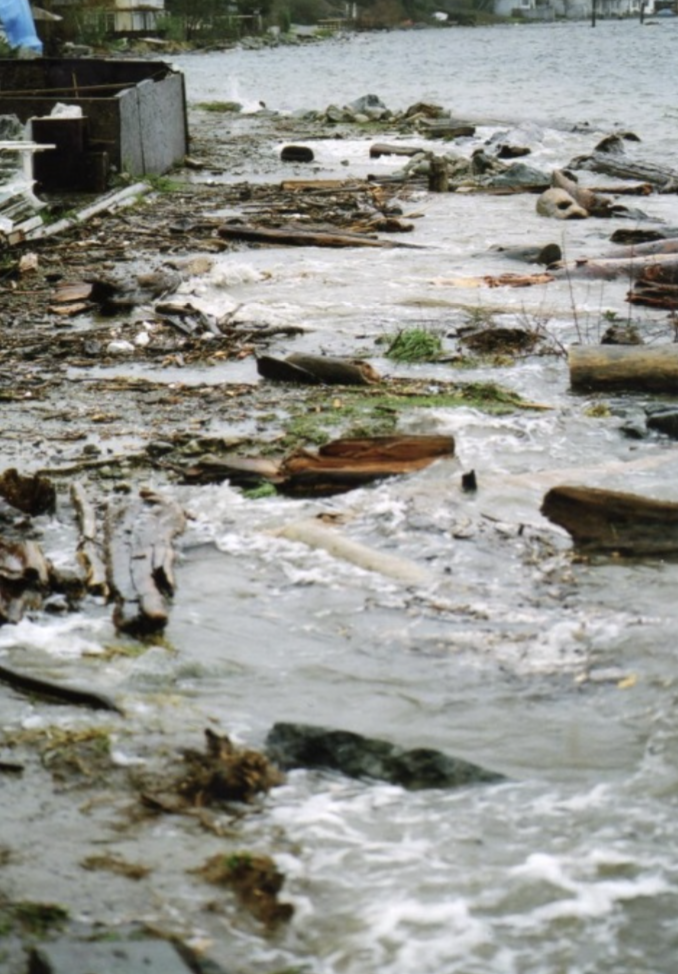
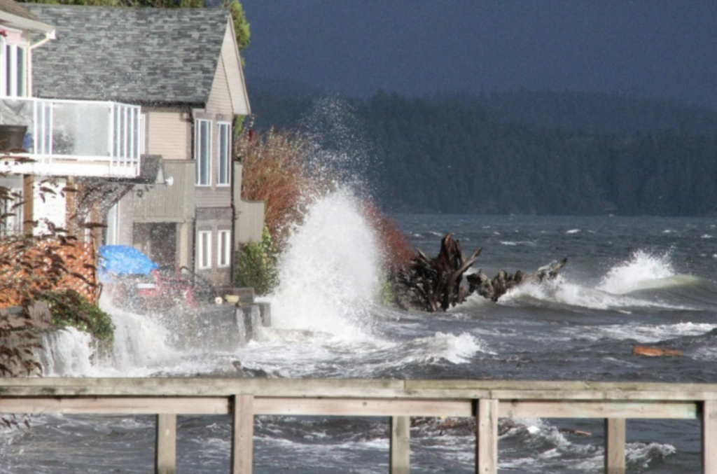
In March 2016, part of Winn Road and private property planned for development flooded.
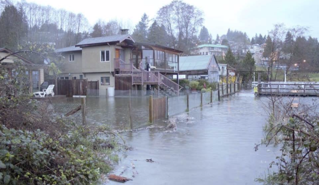
On October 14, 2016, a storm coinciding with extreme tides sent water over seawalls in areas around Armours Beach. Roper sent another letter to council, asking the town what could be done. There was no response.
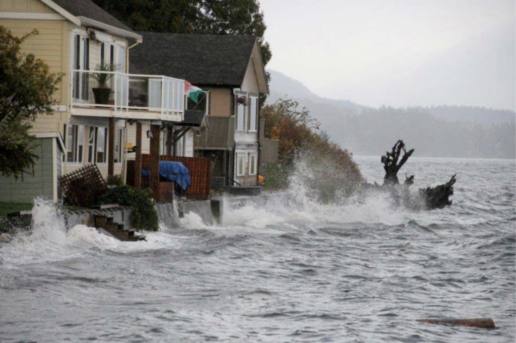
New damage to the sea wall in the Armours Beach area occurred on February 5, 2017.
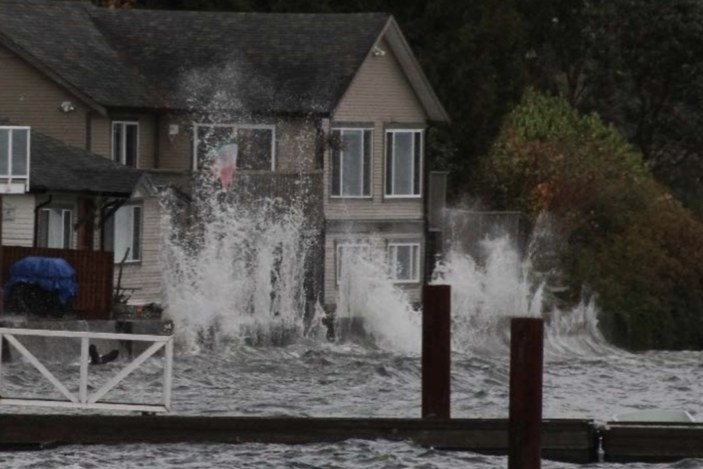

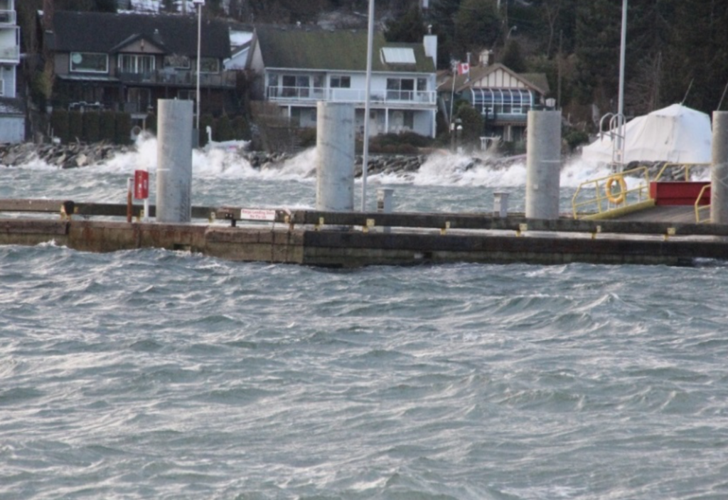
On December 20, 2018, waves surged onto the sea walk at Armours Beach with the water level about 1 foot below the top of the steps.
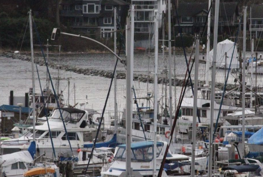
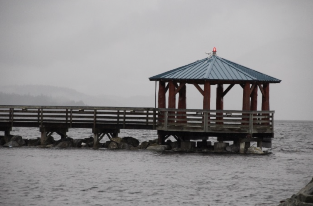
At the public dock, the water level was close to the breakwater. Although the predicted height of the tide was 4.6 metres, low air pressure led to an actual height of 5.2 metres.
On February 14, 2019, waves topped the breakwater that protects public moorage, and reached a number of waterfront homes.
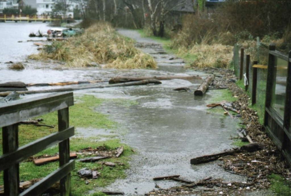
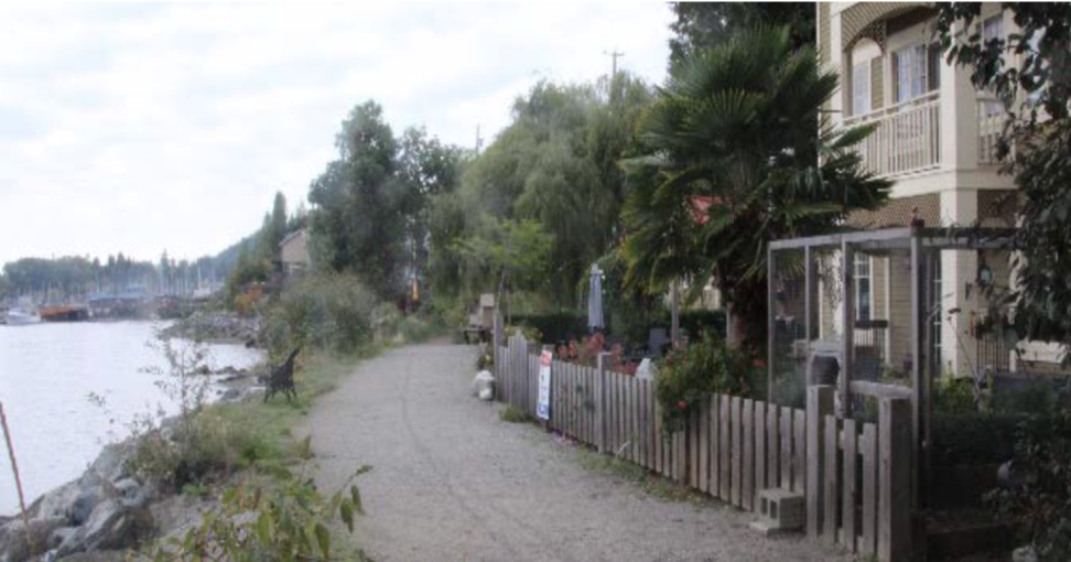
There is no official recording station for tidal heights in Gibsons Harbour, but Roper has kept a private record of recent tide lines on the fence on water side of a proposed large waterfront development.
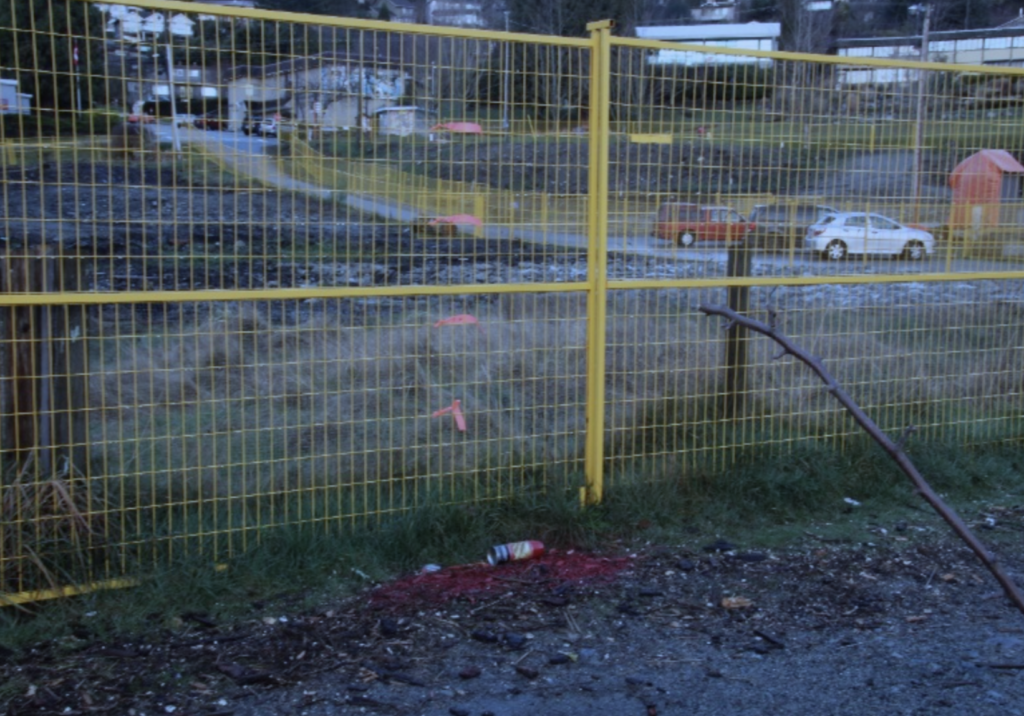
The lowest red marking is the tideline left by a 4.6-metre tide on December 20, 2018, with a low barometric pressure of 973 millibars and a southwestern wind of about 35 knots. The pink tape above it is a 5.1-metre tide, as occurred on December 26, 27 and 28, 2018.
The marking above that indicates the level of the same tide under the same ]with a one foot (0.3 metre) rise in general sea levels, while the one above it shows the height the tide would reach with a two-foot (0.6 metre) sea-level rise. The top-most marking is the level of a 5.1 metre tide under the same weather conditions with a three-foot (0.9 metre) sea level rise.
“How and when will this small coastal community receive the assistance it needs from federal and provincial governments to develop and implement plans and procedures over the next five years for its adaptation to sea level rise to safeguard its future physical and economic sustainability?” asks Roper in his report.
He also wonders what measures are in place to limit financial liability of the town and its taxpayers against potential losses from inadequate provision against sea-water flooding over the anticipated lifetime of any waterfront construction.
The full report can be read here
Note from John Roper: My report was prepared as a voluntary community service with the author’s observations of tides and weather system effects, based on his 32 years’ experience as a certified instructor in command of training vessels based in Vancouver and Gibsons. While information presented herein is believed to be accurate, it should not be used as a basis for construction without review, design, and supervision by a currently practicing registered professional engineer.
John Roper, B.A.Sc. University of Waterloo 1962Professional Engineer B.C. #13,154, Non-practicing President, Turbotech Marketing Incorporated (1983) P.O.Box 692 Gibsons, B.C., V0N 1V0
I’ll be sympathetic as long as waterfront owners pick up their own mediation tab. Headlands road got its name for a reason.
Mother Earth, and in this case Her Sea, always wins. Always.
In January 2016 Andre Boel writes “Climate Change and Sea Level Rise are a serious concern for our future and in the coming years the Town will continue to further develop strategies for new development and infrastructure to adapt to a changing environment.”
More than three and a half years later, the draft of the town’s strategic plan for 2019-2022 says the town wants to develop and adopt a comprehensive climate resiliency strategy.
Does anybody notice these are all empty words?
This looks like an alarming, but realistic, report, well done John Roper!